Newcastle Island, Nanaimo

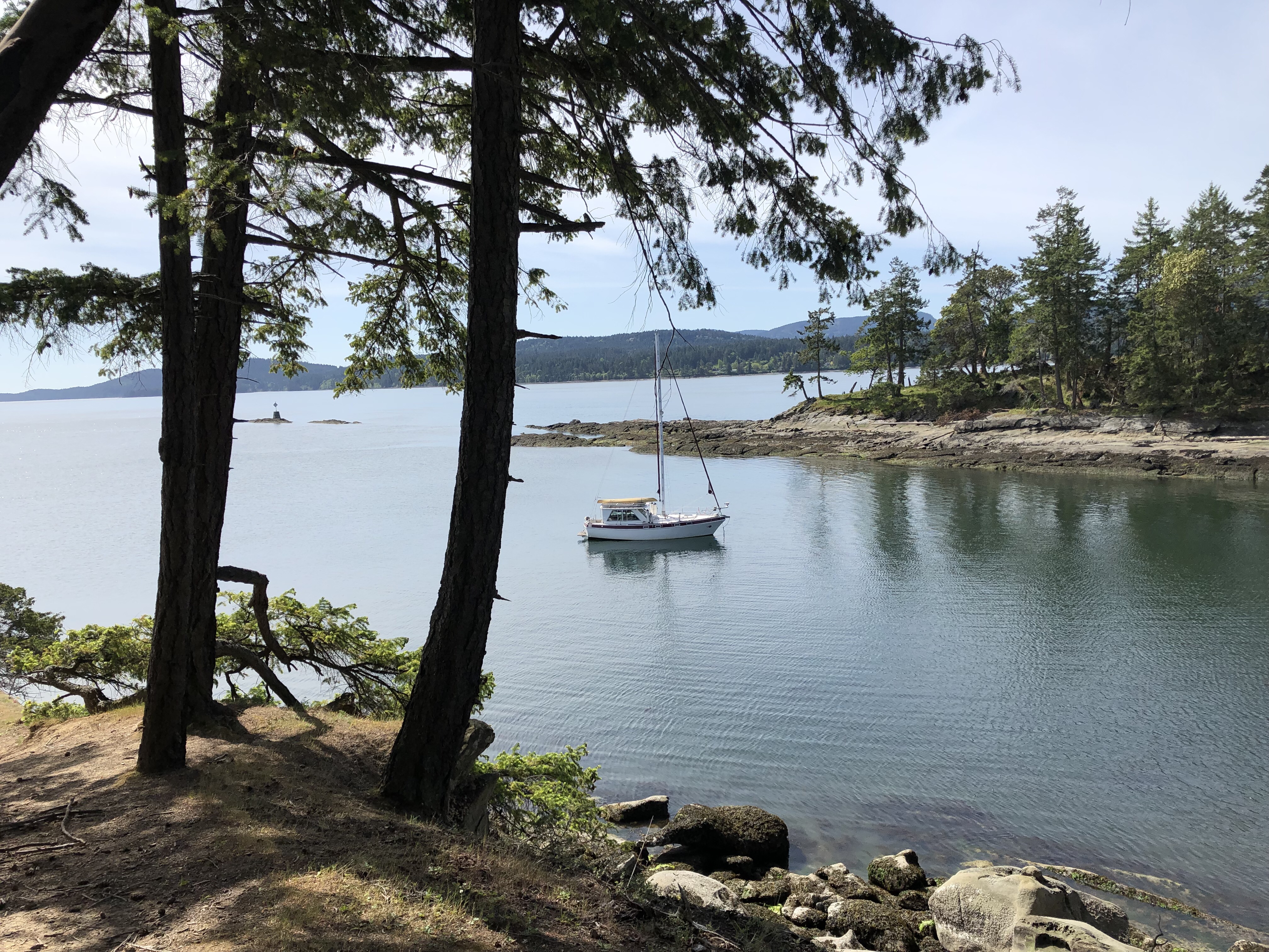
Monday, May 13. Yesterday we left the dock in Nanaimo, went across the channel and dropped anchor off of Newcastle Island. We are still hanging around waiting for some parts. Canadians don’t deliver mail on Saturday and were even rather horrified at the very idea. Hopefully our package will arrive today. We have a tracking number but all it says is: May 10, arrived at facility in Canada. Big help that.

Staying at the dock was convenient for loading groceries and doing laundry but the noise, lights and smells (smog) were unpleasant. One thing we enjoyed at the dock was the musicians. They come down and play for hours for tips. When one quits, another starts up. They were great, with one exception (I would’ve paid him to stop playing!).

Newcastle Island is a marine park with a small lake and many trails. There is one part of the trail, near the lake, that meanders through an old growth cedar forest. The photos simply cannot capture the deep calm of such a place, but we tried.

There is an abandoned rock quarry that looks like a stone graveyard with huge, moss-covered sandstone blocks lying around. This stone was shipped to San Francisco in the 1800s and used to build the mint. Just offshore from the quarry is an old piling with bras tacked all over it. They look like faces. We’ll try to get a better picture from the water when we go by. There must be a backstory, probably involving teenaged boys and rites of passage, but we don’t know it.

Quarry, Newcastle Island
The Bra Pole from Newcastle Island.
The Bra Pole from the passage.
Madrona forest, Newcastle Island
Old growth cedar forest. Hard to tell the size, but these were huge.
Old growth forest. Note the size of the trunk is nearly as wide as the road.
Old growth forest.

Nanaimo, Vancouver Island B C

Friday, May 10. We got up at O Dark Thirty this morning to catch the slack tide at Dodd Narrows. Dodd Narrows is the northernmost pass connecting the Gulf Islands with the Strait of Georgia, so we are done with the Gulf Islands for now. On a spring tide, the current at Dodd Narrows can run up to 9.5kt. Our hull speed is 7kt, so you figure it out! Even at just a few knots, it’s dangerous because of tide rips and whirlpools. That can ruin your day. (Note: we did not take the pics of Dodd Narrows, I stole them off the internet. )

We did it perfectly. This morning was beautiful and calm. I actually had to slow the boat down to keep from arriving at the narrows too early. Because we chose an early morning tide, there was little boat traffic. We glided through and on into Nanaimo Harbor. I freaked out when I saw the tiny space between two other boats where they wanted me to park Calliope. Like parallel parking a tank. But all went well, people on the dock always appear to help.

We did some grocery shopping and laundry. We’ll be here at the dock until Sunday but we have to hang around until Monday or Tuesday waiting for some parts. We like Nanaimo but after the peace of the Gulf Islands, it’s noisy and smelly with lots of lights. On Sunday, we’ll move across the narrow channel and anchor off of Newcastle Island while waiting for our parts. Then we’ll cross the Strait of Georgia and head north.

Newcastle Island is a marine park with many trails to explore. When we came here last summer we couldn’t figure out why we were the only people walking around on this island. Then we came to some “crime scene” tape warning us not to cross with signs saying there was a cougar on the island. That sort of cut short our explorations. So, providing the cougar has not set up permanent residence, we will explore further while cooling our heels waiting for parts.

Dodd Narrows
Nanaimo Harbour

Pirate’s Cove, DeCourcy Island

May 8, 2019. We didn’t actually anchor in Pirate’s Cove because it is open to the NW winds, which were blowing. But there it is (above). Instead we anchored on the south side in a small bay that doesn’t seem to have a name. There are several trails that connect, a very nice and mellow walk.

We had another hairy ride up here from Wallace Island, mainly because of a 16kt NW wind with 20kt gusts. The real problem was some squirrelly currents coming in from Porlier Pass and traveling clockwise around Reid Island causing a strong current opposing the wind between Reid Island and Clam Bay. Didn’t see that coming! In the weeds again. 🤨

Bay just south of Pirate’s Cove.
West view from anchorage (Vancouver Island)
View to the south from footpath.
We love Calliope!
Canada geese and goslings.

Sunrise Bay, Wallace Island

May 7, 2019. We have been anchored in this little nook between Panther Point and Picnic Point on Wallace Island for the last four days. We’re leaving in a few hours for Pirate’s Cove on De Courcy Island.

While here we have seen eagles, Canada geese, marmots, sea otters, a deer and many other birds. This island is basically a 3 1/2 mile long by 1/2 mile wide rock. Yesterday we hiked to the other end, Chiver’s Point. We have never seen so many Madrona trees! (called Arbutus here) Course, Madronas seem to like harsh conditions: growing in rock with gale force winds and salt spray half the time. Perfect place for them, this is.

There are two popular coves, both on the west side: Princess Cove and Conover Cove. We missed the trail to Princess Cove and were too tired to take it on our way back from the point so no pics of that one. Conover cove is named after the people who once lived here and ran a youth camp on the island. The remains of their house and a store (or gathering place?) are in Conover Cove. The “store” is now a leaky shack where hundreds of people have carved their names or the name of their boat on driftwood or whatever they could find and attached it somehow to the building (see photos).

Otter. A pair of these came around to feed every evening.
Canada geese on Picnic Point. A pair of these hung out here every morning.
Panther Point taken from Picnic Point.
Lunch at Chiver’s Point. Alan called this tree, “the bravest soldier” because it was growing furthest out on the point, apparently right out of the rock.
Conover Cove, narrow and shallow.
Conover Cove “store”.
Inside the “store”.

Montague Harbor

May 3, 2019. Yesterday we were able to sail all the way from Winter Cove to Montague Harbor, about 12 nautical miles. We only had to tack three times, with a beam reach turning to a broad reach. It’s a rare day when there is both enough wind and it’s in the direction you want to go! We averaged 4.8kt over the entire trip. Not bad. We did have to motor across a ferry traffic lane to avoid being run over by a monster ferry coming through Active Pass from Vancouver.

Montague Harbor has two sides, a NW and a SE. Last summer we spent one night anchored on the NW side. Nice trail but it was very busy in July. This year we decided we were early enough to chance the more popular SE side, especially since the wind over the weekend was predicted to be coming from the NW, making that side bumpy.

Ye gads! Mooring buoys everywhere ($14 per night)! Lights on every buoy, docks and shore. Traffic noise. Humongous overhead power lines. Worst of all, a float plane dock. So we went in and dropped our anchor right in the middle of the mooring buoys. This earned us dirty looks from both the park people and other boaters in dinghies. This morning we rowed into shore and walked around the beautiful trail. When we got back, 15 boats and two float planes had arrived and were still coming. We decided to get outa Dodge.

Motored 6nm NW to Wallace Island. We anchored in a little tiny nook on the south side called Sunrise Cove. It isn’t listed as an anchorage on any charts or guidebooks, which are the best kind. We have it all to ourselves and we will hide out here over the weekend.

Also on Wallace Island are two very popular anchorages: Conover Cove and Princess Cove. Conover is very shallow and our boat draws 4.5 ft so we decided against that. Besides being popular, Princess Cove is open to the NW winds, so we decided against that. The long and narrow island is a marine park with trails connecting the coves. We’ll hike them tomorrow and bring back pics. In the meantime, here are some photos of Montague Harbor.

SE Montague Harbor entrance
SE Montague Harbor
NW Montague Harbor
Have you hugged a tree today?
There was treasure in there!

Winter Cove, Saturna Island

Boat Passage taken from our anchorage.

April 30. Yesterday we sailed across Swanson Channel until we ran out of wind. We had a 10kt NW wind and were sailing on a beam reach at 4.5kt. It doesn’t get any better than this. We sail as much as we can but it’s a hit and miss operation. Wind funnels down channels and either disappears or kicks your @ss as you round a corner. So we rounded the north end of Pender Island and the wind disappeared. We motored the rest of the way to Saturna and set anchor in Winter Cove. This is another calm, peaceful, well-protected anchorage with a marine park and a short trail. There is a very narrow passage (Boat Passage) leading to the Strait of Georgia. It creates a counter-clockwise current in this very shallow cove when the tide is coming in, clockwise when tide is going out.

Calliope II
Boat Passage looking toward the Strait of Georgia
Winter Cove
Probably our last sighting of Mt. Baker for awhile. Mt. Baker is Alan’s lodestone.
Sea otters fornicating, noisily.

Russell Island

We stayed two days anchored off of Russell Island. We didn’t take our iPhone ashore so, no pics. But we stole these lilacs (Alan’s favorite). There is an old homestead on the island. The heirs donated the island to the province and it is now a marine park. There seem to be a lot of these. The heirs either can’t or don’t want to pay the taxes. Often the deal includes a clause that the family can still come and stay at the house for vacations. This area had a lot of Hawaiians. It seems they came here to work, similar to the Chinese in San Francisco. The homesteader wife on Russell Island was Hawaiian.

Butchart Gardens

Friday afternoon we grabbed a mooring buoy in Butchart Cove. These are free but stay is limited to 24 hours. We spent most of Saturday totally enthralled in the gardens. Then we had a bit of a rough ride back up Saanich Inlet to anchor off of a small island called Russell. It’s a marine park just south of Salt Spring Island off of Swanson channel.

The main internet provider in BC is Rogers. It comes and goes and even when it comes, it’s slower than AT&T. How spoiled we are. Anyway, I call him Roger, mostly affectionately. This morning Roger is giving me two bars. I’ll upload as many images as I can stand.

Amanogawa flowering cherry. You just HAVE to touch them!