Kingcome Inlet (Wakeman Sound and Belleisle Sound)

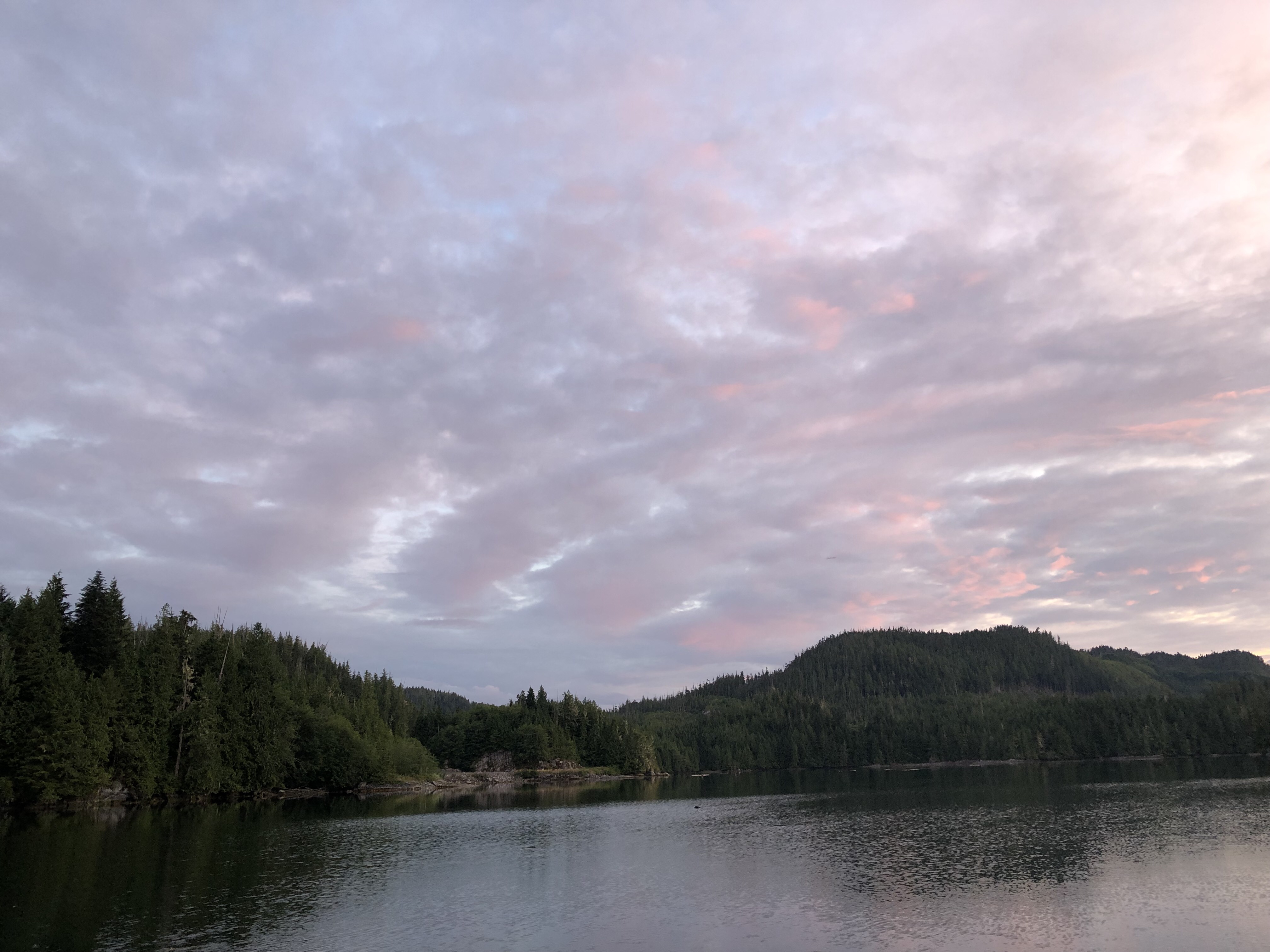
Monday, July 22. We were getting low on fresh water, so we looked at the charts to find the nearest glacier. Saw one on a mountain adjacent to Wakeman Sound, feeding a lake with a creek running into the sound. It was around the corner from Shawl Bay about five miles up Kingcome Inlet, hang a left at the entrance to Wakeman Sound, go another 4 or 5 miles, anchor in the deep and steep with a stern tie to a rock right in the middle of the creek. Piece of cake.  Except that the wind was blowing.

In summer the land heats up and the cooler air over the water funnels through the channels up to the mountains.  Depending on how hot it is, this wind can start up at 10 AM and not taper off until late in the evening. Or anytime in between. One usually finds an anchorage that will be protected from this wind.  But our creek wasn’t one of them. Can’t have everything. We ate dinner, hoping the wind would calm down so we could start ferrying water in our dinghy. It kinda worked. Some. We made six trips with 13 one-gallon jugs before it got too dark and we got too tired. Almost filled our tanks. A couple more trips would’ve done it. Oh well. We should have enough water to last until we get back to our favorite waterfall up Ramsay Arm.  By then it was almost calm.  We spent one night there listening to the water flow and a bird with a beautiful song who sang most of the time we were there. 

Next day we went back down Wakeman Sound, up Kingcome Inlet again about a mile and hung a right into Belleisle Sound. This was pretty but there was already a boat in the only good anchorage. We anchored in another spot but it was open to the wind, which didn’t stop much. I did catch a few rock cod for dinner.

We had planned to go up to the head of Kingcome Inlet but the tides weren’t favorable, so we’ll save that for another time. 

Waterfall, Kingcome Inlet.
Wakeman Sound.
Belleisle Sound.
Kingcome Inlet.

Shawl Bay, Mainland

Saturday, July 20. Yesterday we left Dreary Inlet and spent another night in Carriden Bay. This morning I was fishing (as opposed to catching) off the stern. The tide was out and a whole bunch of rocks were exposed. At the very end of the rock shoal, out past all the other rocks, was a really funny looking rock. 

Very roundish and gray and propped up at an odd angle. I was thinking I would get the binoculars and check it out when suddenly it moved!  I got the binoculars and it was an old, gnarly, fat seal, just lying there on his side. He turned, looked right at me, then raised his flipper and I swear he waved at me!  I took a fuzzy picture of him. 

We left at the flood tide to head up Sutlej Channel in search of an internet connection. There is a marina at Shawl Bay but it is currently closed.  A kind fellow there let us use his WiFi to send a very short message.  Caught a few sea bass here. 

View from Sutlej Channel toward Kingcome Inlet.
View from Shawl Bay, toward Sutlej Channel.
Sunset in Shawl Bay.

Drury Inlet, mainland

Tuesday, July 16 through Saturday July 20. On Tuesday morning we braved Stuart Narrows just before high slack with a 2.5 kt following current. Whoopee!  

We anchored in Tancred Bay (just inside the Narrows), Jennis Bay (north side of Drury Inlet) and the Muirhead Islets (at the far west end of the inlet).  

It has rained most of the time we have been here. There are only low hills separating the inlet from Queen Charlotte Strait. Queen Charlotte’s job is making clouds. She makes clouds all night. If it’s calm in the mornings, we are socked in with fog. If it’s windy, the clouds fly over these hills and drop their moisture. 

We had planned to go through Actress Pass to explore Actaeon Sound but decided against it. This area is currently being (and has been) heavily logged. This morning we heard blasting up that way. The trees are sad and the land feels and looks desolate.  We’ve decided this should be called Dreary Inlet. 

This morning I caught and lost another salmon. Dang!  These guys are so tricky. I had him on my line when he suddenly swam toward me, making the line slack, jumped about two feet out of the water, did a little flick and got loose from my hook.  I hope I can catch and keep one some day. 

Stuart Narrows, looking east. Mt. Waddington in background.
Stuart Narrows, heading west.
Jennis Bay, Drury Inlet.
Muirhead Islets, Drury Inlet.

Carriden Bay, mainland (just outside Stuart Narrows)

On Monday, July 15, we sailed to Sullivan Bay Marina on North Broughton Island for some fresh veggies.  Next we plan to explore Drury Inlet and Actaeon Sound, but we have to traverse the entrance to Drury, Stuart Narrows. Because the tide wasn’t right for that, we anchored in Carriden Bay to wait for the tide on Tuesday.  The view of Mount Waddington is awesome from here. Waddington is the highest mountain in BC.

Mt. Waddington, from Carriden Bay
View from Carriden Bay.
Sullivan Bay Marina. All floating. Quaint, if you like that sort of thing. Too busy and crowded for us.

Napier Bay, North Broughton Island

On Saturday, July 13, we left the beautiful Polkinghorne Islands and went trolling for salmon from Boyles Point along the shore on the mainland going up Wells Passage. We could see fish everywhere on the sonar, but not a bite. There were a couple of other boats fishing, but also not catching. I sure wish I could catch a salmon. Just off of Boyles Point I heard Alan yell, “Whoa” again. Another humpback. This time he only saw the tail as the whale dove. Where was I?  In the back with my pole. It wouldn’t be so bad if I actually caught a salmon. 

We gave up on the salmon and motored to Napier Bay. This area has been extensively logged and the loggers left behind a mess. It was once beautiful and will be again, but right now it is in recovery. I took a spin in my kayak and saw another black bear. These Broughtons are literally crawling with black bears. We have seen one or more at every anchorage. 

Napier Bay
Napier Bay

Polkinghorne Islands, Queen Charlotte Strait

July 11-13. Furry Eyeful Alert!  This was a very beautiful anchorage.  On our way here we screwed around fishing an underwater mound out in the strait. The depth of the mound was 18 feet but quickly dropped to about 200 feet all around. Fish like to hide on the lee side (out of the current) so the trick is to drift across with the current and let your lure bounce down the leeward side. I caught another nice sculpin but nothing else. Was hoping for salmon, halibut or ling cod. But sculpin is excellent eating. Maybe better than halibut and certainly easier to catch. Reeling in a halibut is like reeling in a piece of plywood. 

These are many small islets collectively known as the Polkinghornes. We  entered through a narrow channel between rocks, threaded our way through the kelp beds and dropped the hook. I have never seen so much kelp in my life!  This was another kayakers dream and I spent a pleasant afternoon paddling around, sneaking up on a loon and a fat seal taking a nap. Beauty is found in every direction. We are so fortunate. 

Caught another three sea bass and gathered more sea asparagus and sea plantain. Mmmmm, dinner!  Why do I always seem to catch three fish?  Because usually one or two are smallish and I’m not sure they will be enough for a meal for two. As soon as I get a meal, I stop. Bad karma to be greedy. 

Creature from the Polkinghorne Islet.
Gnarly cedar on Polkinghorne Islet.
Polkinghornes.
Calliope in the Polkinghornes.
Polkinghorne Islands

Aimee Bay, Broughton Island

July 10, 2019.

The evening before we left Patrician Cove, I caught three sea bass. Salmon were all around but would not take the hook. I decided to troll for them the next morning as we left,  threading our way through the islets to cross Queen Charlotte Strait. That turned out to be a big mistake. I was in the back of the boat, tending to my pole, when Alan yelled, “WHOA”!  I turned to look at him and then to look where he was looking. All I saw was something gray and a HUMONGOUS SPLASH.  I totally missed a humpback whale that leapt completely out of the water not 30 feet from Calliope’s bow! Alan said it was bigger than our boat. The wake from the splash knocked us around some. 

We crossed the strait and headed for the Polkinghorne Islands but changed our minds about anchoring there. The anchorage is open to the northwest and the southeast and a strong southeast wind was in the forecast. Instead we headed for a more protected anchorage called Aimee Bay, just a couple of nautical miles further north. 

Before leaving Aimee Bay we decided to row to shore and walk about a bit.  Alan said we didn’t need the air horn because there were no bears there.  I asked him how he knew and he said he’d been watching. We took off, sans air horn. Of course you can guess what happened. As we neared shore I heard a sound like a rock slamming another rock. This is what you hear when the bears are busy turning over rocks looking for food.  I looked toward the sound and saw only rocks, logs and a stump. Then the stump moved!  Alan hollered, the black bear turned and looked at us and sauntered off into the woods. Slowly. Bear be like, “you ain’t makin’ me do nothin’ I wasn’t already gonna do.”

Mt. Waddington from Queen Charlotte Strait.
Sea Bass caught in Patrician Cove.

Tex Lyon Trail, Vancouver Island

July 8. We only hiked 2 km of this trail today. This is the most challenging trail I have ever hiked, and I have hiked the Pacific Crest Trail from hwy 20 to Stehekin and the Olympic Trail from the Olympic Rain Forest to Sol Duc, among others. I’ve never seen anything like this. Two km today and three yesterday wiped our old a$$es out. The entire trail from Fort Rupert to Dillon Point is 6 km (12 km round trip). Seems like that could kill a person. They say it takes 8 hours. We saw a squirrel and a frog. No 🐻.

Tomorrow we head across Queen Charlotte Strait for the Polkinghorne Islands. We heard there is good fishing there. I caught a rockfish this morning but threw him back. I SAW salmon (one surfaced right in front of the dinghy!) but they weren’t biting. So frustrating. After the Polkinghornes, we go to the Broughtons. Will probably lose poor ol’ Roger again.

Tex Lyon Trail I.
Tex Lyon Trail II.
Tex Lyon Trail III.
Tex Lyon Trail IV.

Patrician Cove, Vancouver Island

Sunday, July 7. We left Sointula yesterday (motto: We don’t care. We don’t have to. Nuff said.). We headed north to a small niche called Patrician Cove, just north of Fort Rupert and around the corner from Port Hardy on Vancouver Island. On the way we passed Pulteney Point and took a pic of the lighthouse (maybe we’ll start another page for lighthouses).

This morning a large whale came in here and circled around a few times. Our pic looks like it could just be a rock so you’ll have to take our word for it. I was musing that we could get much better pics of the creatures if we had a camera with a telephoto lens. Alan says, well, we could get one. But that’s just one more thing to keep track of and take care of so if you want to see a GOOD picture of a whale or a bear or an eagle or a sea lion, go find a National Geographic or something!

Whale just outside Patrician Cove

There is a great, if a bit arduous trail along the coast, starting at Fort Rupert. The website says that reports of sightings of wolves and bears are posted at the trail head. No help there as we are anchored somewhere in the middle of the trail. We went anyway, armed with whistles and an air horn but we saw nothing but forest and beach and water. Next time I see a bear I’m gonna blow the air horn and see what happens because those last guys didn’t even look up when we yelled, safely ensconced in the boat. Today we hiked north for a few km. Tomorrow we’ll go south, toward Fort Rupert.

Fort Rupert from Patrician Cove
New moon in Patrician Cove.
View from trail.
Calliope in Patrician Cove
Eagles are everywhere!